Mineral Resources Index Download service documentation
Version: 0.2.0
Editor: Marianne B. Wiese (GEUS)
Scope
This TCS GIM Mineral Resources index download service documentation is here to help the end user understand the Mineral Resources index model and use the download service.
Searching data in the Mineral Resources index content
The services
The TCS GIM MineralResourcesIndex is an implementation of the MineralResources Index data model and contains discovery information for geological models of any kind. Two services were created for mineral resources discovery through geographic visualisation and discovery data, and data access through access to landing pages or linked services:
-
The Mineral Resources View service for visualising the content of the service.
-
The Mineral Resources Download service for data digestion and dereferencing.
Mineral Resources View service
The Mineral Resources View service is a Web Map Service (WMS) that follows the specifications of the Open Geospatial Consortium (OGC) standard WMS 1.3 (https://www.ogc.org/standard/wms/), which also is ISO 19128 standard (https://www.iso.org/standard/32546.html). As such, it can be used as part of the EPOS data portal but also interfaced directly.
The base address for the Mineral Resources View services is:
https://data.geus.dk/eposmine_index/wms
The capabilities document (GetCapabilities) for the WMS service is available at:
https://data.geus.dk/eposmine_index/wms?service=WMS&version=1.3.0&request=GetCapabilities
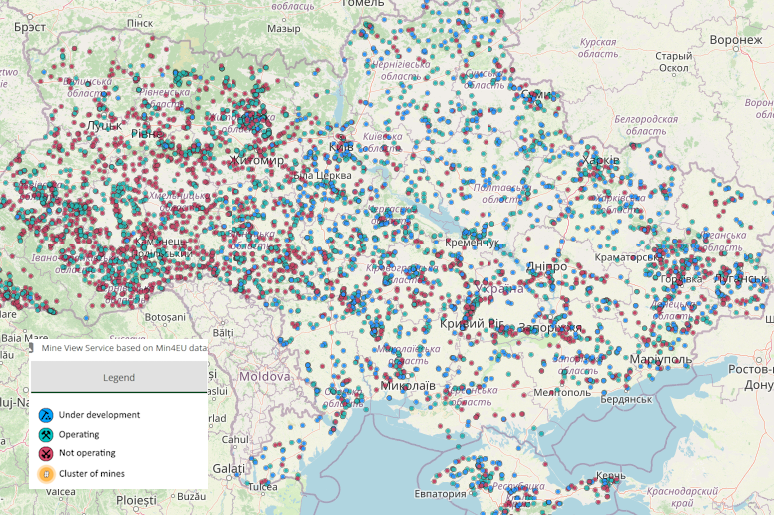
The Mineral Resources View service consists of one layer that displays the location of the mines and provides discovery data on request (GetFeatureInfo)
Query parameters of a straight Mineral Resources View WMS request include the coordinate reference system (crs), the image format (format), the image width and height, and the geographic bounding box (bbox), as in the example below:
http://data.geus.dk/eposmine_index/epos-erml/wms?service=WMS&version=1.1.0&request=GetMap&layers=epos-erml:MineView&bbox=-18.22,27.57,40.22,70.99&width=768&height=570&srs=EPSG:404000&styles=&format=image/jpeg
The Mineral Resources View service does not support filtering of the results (CQL-filters). However, the Mineral Resources Download service provides such functionality.
Mineral Resources Download service
The Mineral Resources Download service is a Web Feature Service (WFS) that follows the specifications of the Open Geospatial Consortium (OGC) standard WFS 2.0.2 (https://www.ogc.org/standard/wfs/), which is related to ISO 19119 standard Geographic information - Services (https://www.iso.org/standard/59221.html). As such, it can be used as part of the EPOS data portal but also interfaced directly.
The base address for the Mineral Resources Download services is:
https://data.geus.dk/eposmine_index/wfs
The capabilities document (GetCapabilities) for the WFS service is available at:
https://data.geus.dk/eposmine_index/wfs?service=WFS&request=GetCapabilities
The schema of the service is available at:
https://data.geoscience.earth/def/epos-erml-lite.xsd
Query parameters of a straight Mineral Resources Download WFS request include the output format (outputFormat) and the geographic bounding box (bbox), as in the example below.
http://geusgeoserver02:5050/eposmine_index/wfs/?service=WFS&version=2.0.2&request=GetFeature&typeName=MineView&outputFormat=json&bbox=44,23,50,30
In addition, attributes can be filtered for content by adding specific parameters (CQL filters) to the query. See section Searching data.
Mineral Resources Index model overview
The Mineral Resources Index model is the data model from which the Mineral Resources View and Mineral Resources Download services were developed. It was modelled from scratch under GML.
Attributes
identifier [CharacterString]:
Multiplicity: ( [1..1] )
A unique identifier (ideally a URI) to identify the Mine mapped feature.
status [MineStatusCategory]:
Multiplicity: ( [1..1] )
Operational status of the mine
commodity [CommodityCode]:
Multiplicity: ( [1..n] )
Commodity or commodities associated with a mine
owner [CharacterString]:
Multiplicity: ( [0..1] )
Name of the current owner of the mine
startDate [Date]:
Multiplicity: ( [0..1] )
Date that mining commenced
endDate [Date]:
Multiplicity: ( [0..1] )
Date that mining finished
observationMethod [mappedfeatureobservationmethodCode]:
Multiplicity: ( [0..1] )
Method used to identify the location of the Mine mapped feature.
positionalAccuracy [CharacterString]:
Multiplicity: ( [0..1] )
Accuracy of the feature location
source [CharacterString]:
Multiplicity: ( [0..n] )
source(s) of information for the mine
representativeCommodity_uri [CommodityCode]:
Multiplicity: ( [0..1] )
A URI to identify the major commodity of commodity group associated with the mine
specification_uri [CharacterString]:
Multiplicity: ( [0..1] )
URI to full EarthResourceML description of the mine feature
shape [gml:GeometryPropertyType]:
Multiplicity: ( [1..1] )
Geometry defining the location of the mine.
Searching data in the Mineral Resources Index content
Mineral Resources Index data are searchable in the EPOS data portal by the latter’s native filter functions, or by querying the Mineral Resources Download service with CQL-Filters added to the WFS query (Note: bounding box and CQL-filters are mutually exclusive).
The full capabilities of the filter function are described in the GetCapabilities document. Use a URL encoding service for the filter content in case you have difficulties with whitespaces and special characters, e.g. https://www.url-encode-decode.com.
Example:
https://data.geus.dk/eposmine_index/wfs/?service=WFS&version=2.0.2&request=GetFeature&typeName=MineView&outputFormat=gml3&CQL_FILTER=gml:name%20ilike%20%27Qui%25%27